How to Prepare GNDVI Green Normalised Differentiate Vegetation Index in ArcGIS RS and GIS with Dr. Manoj 11,1 тыс. подписчиков Скачать
Urban Thermal Field Variance Index (UTFVI) MODEL Using ArcGIS Software in Bangla (থার্মাল ফিল্ড) Скачать
How to prepare Output of DEM, SLOPE, ASPECT map in QGIS II কিভাবে মানচিত্রের আউটপুট প্রস্তুত করবেন Скачать
How to prepare DEM, SLOPE, ASPECT, ROUGHNESS, HILL SHADE in QGIS II কীভাবে মানচিত্র প্রস্তুত করবেন Скачать
Grid setting in study area map in Arc GIS II Co-ordinate setting II Latitude and longitude Add Скачать
How to change projection System/Co-ordinate System in Arc GIS II Geographic to UTM projection Скачать
How to add base map in ArcGIS II Base Map Error II How to solve disable base map error in ArcGIS Скачать
How to Clip State and District Boundary from Using Attribute Table in QGIS II রাজ্য এবং জেলা সীমানা Скачать
How to Extract/Clip State/District Boundary from Shapefile in QGIS শেপফাইল থেকে রাজ্য/জেলা সীমানা Скачать
How to prepare composite map II Multiple maps II Multiple Layout in ArcGIS II River and Vegetation Скачать
How to Prepare Channel Shifting Map of River from LULC in ArcGIS চ্যানেল শিফটিং নদীর যৌগিক মানচিত্র Скачать
Urban Sprawl Mapping ll How to prepare composite map II Urban area II Built-up area Composite map Скачать
How to Create Shape File: Point, Line and Polygon (KML/KMZ file) in Google Earth using ArcGIS Скачать
How to Create River and City Points Multiple Ring Buffer Zone in QGIS II কীভাবে বাফার জোন তৈরি করবেন Скачать
How to Create Points Multiple Ring Buffer Zone in QGIS II কীভাবে একাধিক রিং বাফার জোন তৈরি করবেন Скачать
How to create NDBI (Normalized Difference Built-up Index) using Semi Automatic Plugin in QGIS Скачать
Atmospheric correction of Landsat OLI image by QGIS II Landsat OLI চিত্রের বায়ুমণ্ডলীয় সংশোধন Скачать
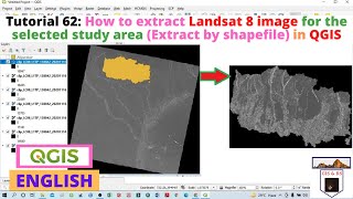
Land Use Land Cover Map of Landsat 8 (Supervised) using Semi Automatic Classification Plugin in QGIS Скачать
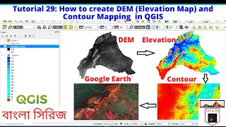
How to create DEM (Elevation Map) and Contour line in QGIS II উচ্চতা মানচিত্র এবং কনট্যুর লাইন তৈরি Скачать
How to add Excel file CSV in Shapefile, QGIS II কীভাবে শেপফাইল এ এক্সেল ফাইল সিএসভি যুক্ত করবেন Скачать
Reclassification of Land Use Land Cover (LULC) in QGIS II ল্যান্ড ইউজ ল্যান্ড কভার এর পুনঃশ্রেণীকরণ Скачать
How to create study area map in QGIS II কিউজিআইএস-এ কীভাবে অধ্যয়ন এলাকার মানচিত্র তৈরি করবেন Скачать
How to prepare Layer Stacking in QGIS or Merged File II লেয়ার স্ট্যাকিং কীভাবে প্রস্তুত করবেন Скачать
How to do Normalized Difference Water Index NDWI in QGIS কীভাবে নরমালাইজড ডিফারেন্স ওয়াটার ইনডেক্স Скачать
How to download LISS III Satellite image from Bhuban ভুবন থেকে স্যাটেলাইট ইমেজ কিভাবে ডাউনলোড করবেন Скачать
How to do Supervised image classification in QGIS IIকীভাবে তত্ত্বাবধান করা চিত্র শ্রেণিবিন্যাস করবেন Скачать
How to do Unsupervised image classification in QGIS কীভাবে তত্ত্বাবধানহীন চিত্র শ্রেণিবিন্যাস করবেন Скачать
How to prepare a decent Print Layout map in QGIS কীভাবে একটি প্রিন্ট লেআউট মানচিত্র প্রস্তুত করবেন Скачать
How to prepare a Choropleth Map Preparation using QGIS II কিভাবে একটি Choropleth মানচিত্র করতে হয় Скачать