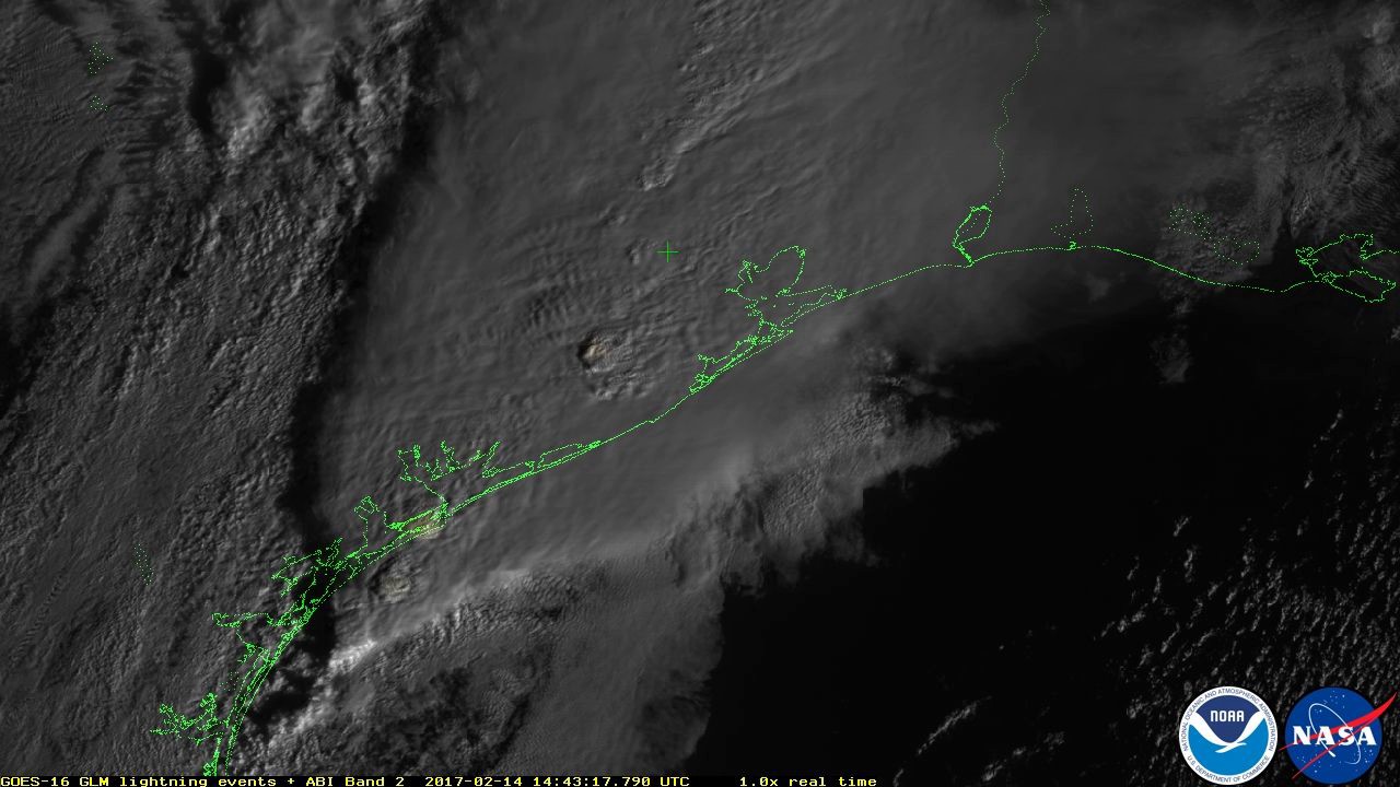
Lightning observed by the GOES-16 Geostationary Lightning Mapper (GLM) illuminates the storms developing over southeast Texas on the morning of February 14, 2017, in this animation of GLM lightning events overlaid on Advanced Baseline Imager (ABI) cloud imagery. Frequent lightning is occurring with the convective cells embedded in this severe weather system. The green cross indicates the location of Houston, and green dotted lines indicate the Texas coastline. This animation, rendered at 25 frames per second, simulates what your eye might see from above the clouds. GLM perceives the scene at 500 frames per second, and can distinguish the location, intensity and horizontal propagation of individual strokes within each lightning flash. Monitoring the flash rate from convective cells and their extent can help forecasters improve tornado and severe weather forecasts and warnings and their impending threat to the public. At the time of this animation, the storm cell in the center of the frame was reported by the NWS to have spawned one of a number of tornadoes and damaging winds spawned by the storm complex.
Credit: NOAA/NASA
Note: This is preliminary, non-operational data as GOES-16 undergoes on-orbit testing.


