Tuesday: Mainly morning rain, then scattered rain showers through the afternoon. Changing to snow showers overnight. High 53, falling into the 30s by midnight. SW 10-15.
New Year's Day: Mostly cloudy and brisk. Few flurries. High 38. W 10-15 G 20+.
Thursday: Partly sunny, with a high near 34.
Expect heavy rain and gusty winds early on your Tuesday morning, with the heaviest precipitation occurring between 6a-10a. Sporadic showers are expected this afternoon, followed by a few snow showers tonight as the colder air arrives.
New Years Day will be quite uneventful with a few snow flurries along with much colder and more blustery conditions.
A weak system will drive in clouds, snow flurries, and reinforce the cold air on Friday.
Saturday will be cold and mostly cloudy.
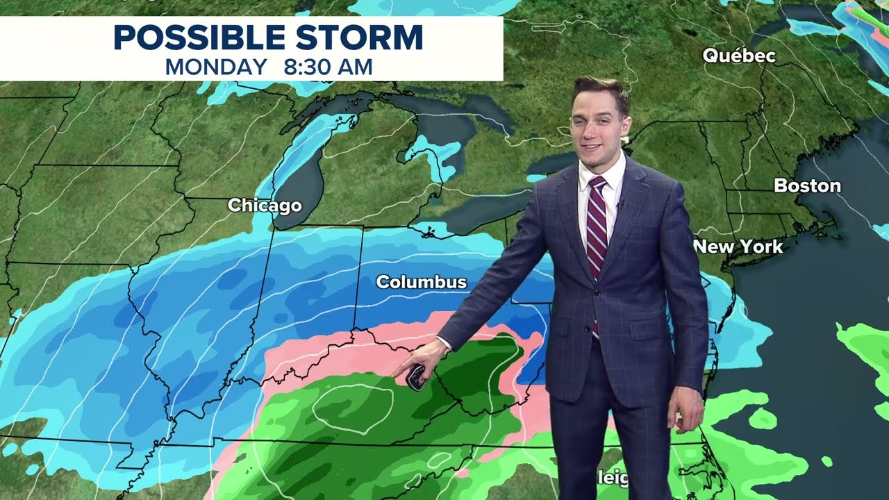
Our attention quickly turns to a robust storm system that develops east of the Colorado Rockies Sunday night into Monday. There will be ample cold air in place, and this system will usher in moisture from the Gulf of Mexico.
At this time, we are looking at the potential of our first accumulating snow event of the winter, however, there are several uncertainties with the track. As of now, the center of the track is forecasted to go over Kentucky, which would put Ohio in the snow belt. However, a northerly shift of a 100 miles could have us looking at an ice storm, and a southerly shift of 100 miles could have us looking at nothing but a cloudy day with some snow flurries.
We'll get a better handle on the situation once we get three days out.


