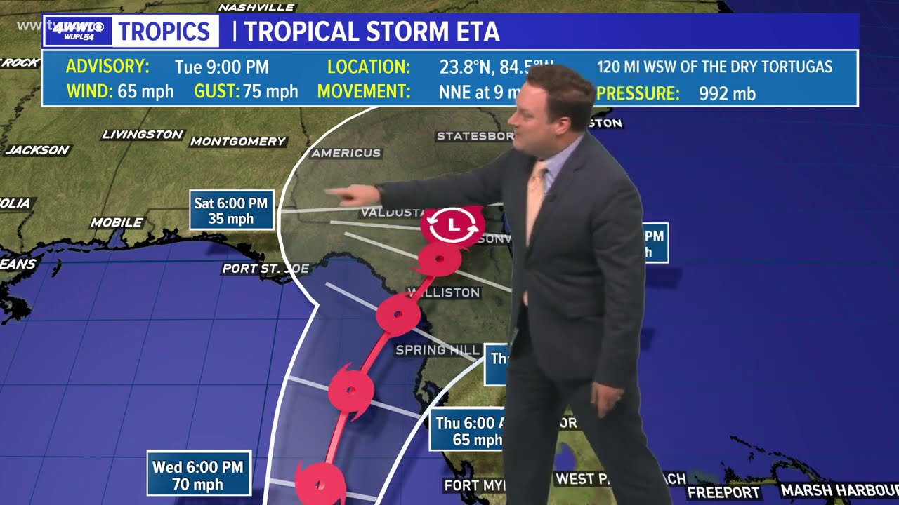
Eta continues along a path generally toward the north. Computer guidance this morning had begun to converge on a landfall of what's left of Eta this weekend along the FL panhandle, but that has changed tonight. Now landfall could be sooner, Thursday, along the west coast of Florida. It appears a cold front moving through the area tomorrow will keep Eta and its associated rainfall well to our east. As most of the wind shear and dry air are located over the west and central Gulf, a track keeping Eta more in the eastern Gulf, while still weakening, does have a landfall as a weak tropical storm, where as yesterday the NHC had the storm dissipating before landfall. Obviously this has been a complicated forecast and one to still watch, but we're looking good in SELA and S MS.


![PENGURUSAN JEMAAH HAJI MALAYSIA TERUS DAPAT PUJIAN [19 JUN 2015]](https://i.ytimg.com/vi/Z4mtDMyCrYc/mqdefault.jpg)


![[120329] Kossuth tér negyedszer...](https://i.ytimg.com/vi/joFUv9jScOI/mqdefault.jpg)


