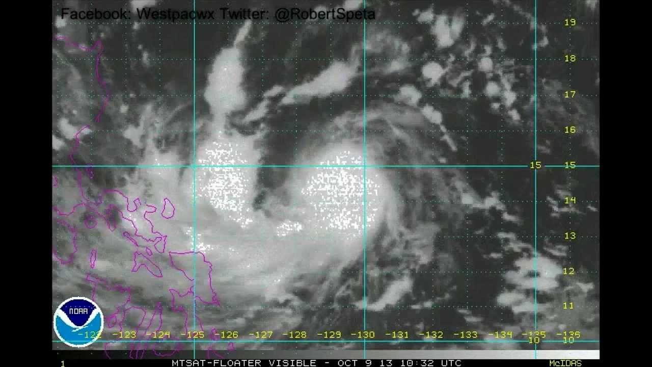
Santi / Nari is spinning up in the Philippine Sea today and is showing signs of likely significant intensification over the course of the next 48hrs.
Per the latest Satellite imagery this storm has become clearly organized on Wednesday with a defined low level circulation and a thick moisture flow coming in from the south. Warm Sea Surface temperatures, low vertical winds hear and good exhaust aloft will aid in its further development as it approaches Luzon.
With that said where exactly where will it be going and how strong will it be when it gets there?
At this time most models indicate this storm system running west along the southern periphery of the West Pac high which has filled in the gap over Okinawa left in behind Danas and Fitow after those storms moved through.
This would take the storm towards the eastern Luzon Sea board north of Polillo island and south of Casiguran likely Saturday afternoon.
Due to ingredients in place it is likely this storm will be making landfall as a Strong Tropical Storm or a Weak Typhoon with winds up to 65-70kts.


![Чебурашка и Крокодил Гена — все серии подряд [HD]](https://i.ytimg.com/vi/aMHFMdAaBTQ/mqdefault.jpg)


